TDM Location Data Management System 6.0
From ICISWiki
Back to Main Page > ICIS 6.0 Home Page > ICIS 6.0 Models & Schemata
MANAGEMENT OF LOCATION DATA
Introduction
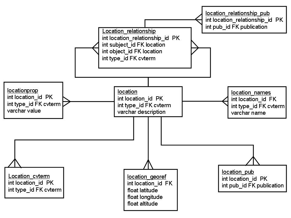
A preliminary ICIS 6.0 model for the location data management system is being developed using the general GMOD Chado schema design patterns. This model requires considerable elaboration.
Data Model
Discussion
The new model encodes most meta-data, including location geopolitical ("subnat") and related meta-data (e.g. geographical descriptors) using controlled vocabulary either directly (in the location_cvterm table) or indirectly (in the location_relationship or the locationprop tables). The location_georef table can probably be elaborated further to include measurement details.

